Paris-Brest-Paris 2011
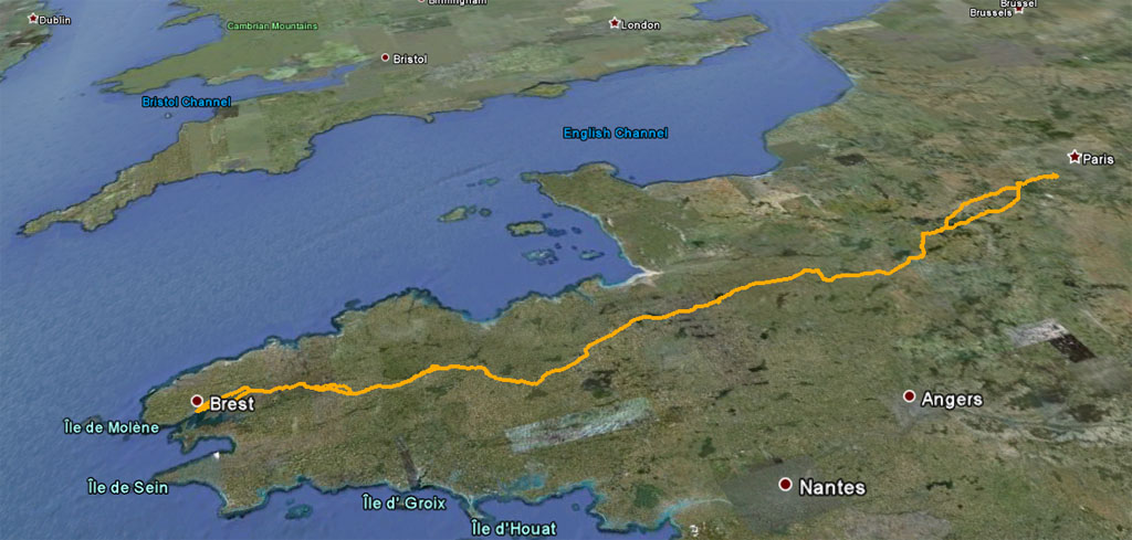
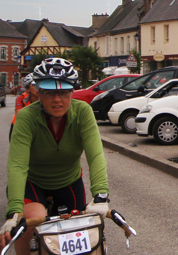
Since 1891, cyclists have been gathering periodically to ride from Paris in the center of France to Brest on the Atlantic Coast. The Ride is sponsored by Audax Club Parisien), the sanctioning organization for Randonneuring clubs everywhere. Successful riders are called Anciens (or Anciennes for women) and their names are recorded in a roll of honor that goes back to first rise. the I was one of sixty members of the Seattle International Randonneurs club who participated in PBP 2011 with over 5000 riders from all over the world. The distance is 764 miles (1230 kilometers). The maximum time limit is 90 hours including all stops.
CAUTION: This report is long and hilly. It many side trips and bonus miles. You only have 90 hours to finish (84 hours if you start tomorrow morning) or you won't get homologated. And no one wants that.
The first question to answer is "What is it like?". Well, that depends on a lot of things: what your expectations were, what time you started, where you slept (if you slept). It was five thousand different rides for different people.There are a lot of great ride reports that focus on the experience of riding PBP and I will talk about my experience there but I will also try to add some things that you might not know about the places we went and the people who live there and how it came to be what it is.
For myself, I would have to say the ride exceeded all my expectations. It's hard to describe how much I enjoyed it. I was grinning like a fool most of the way. The top reason (as you will see in nearly every story you read about this ride) is the great people who live along the route who come out to cheer and support the riders along the way. This may be normal in France but where I come from it is definitely not normal. In the USA the expected reaction to "I'm riding my bike 750 miles and I am going through your town." is somewhere between "Why would you do that? That's insane. I get tired just driving that far" and "Get the @%{*$ off my road!!!" Here we were in an alternate universe where the reaction was "That's fantastic! Enjoy yourself! How can I help?".
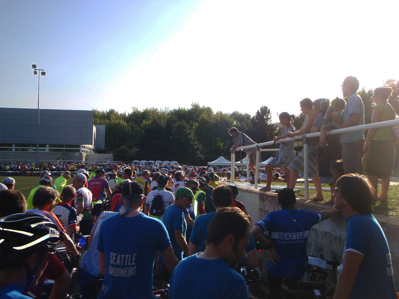
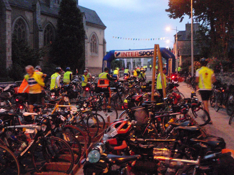
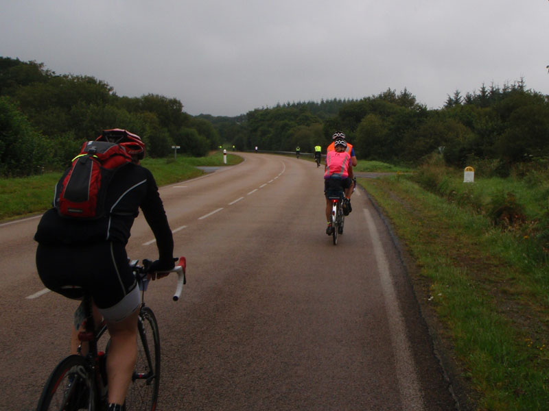
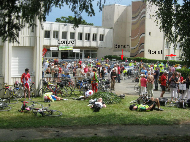
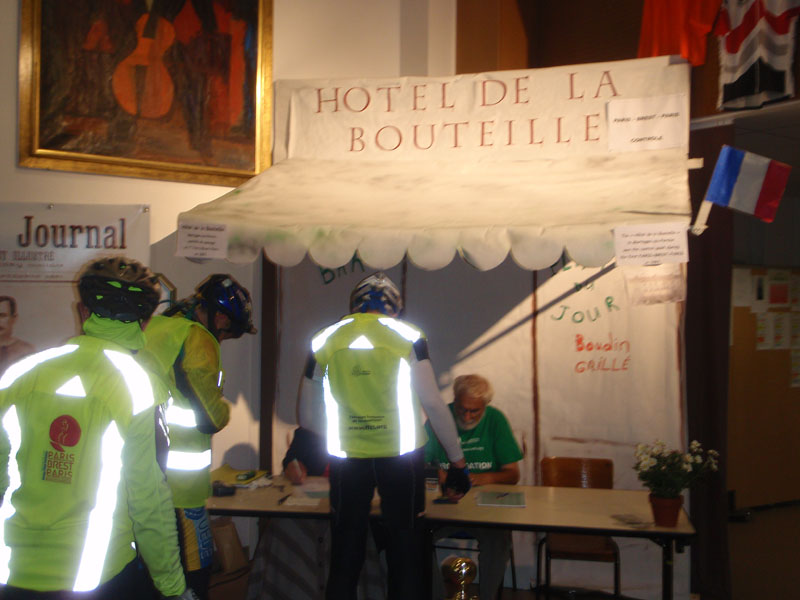
The start was slow. A group of us went down to the start area at about 4:00 and ended up standing in line for about 4 hours in the sun waiting for the start. We were at the back of the 90 hour mass start. But it was a spectacle. I decided when I signed up that is was going to be the whole enchilada - mass start, no support, sleeping at the controls. I just was happy to be there.
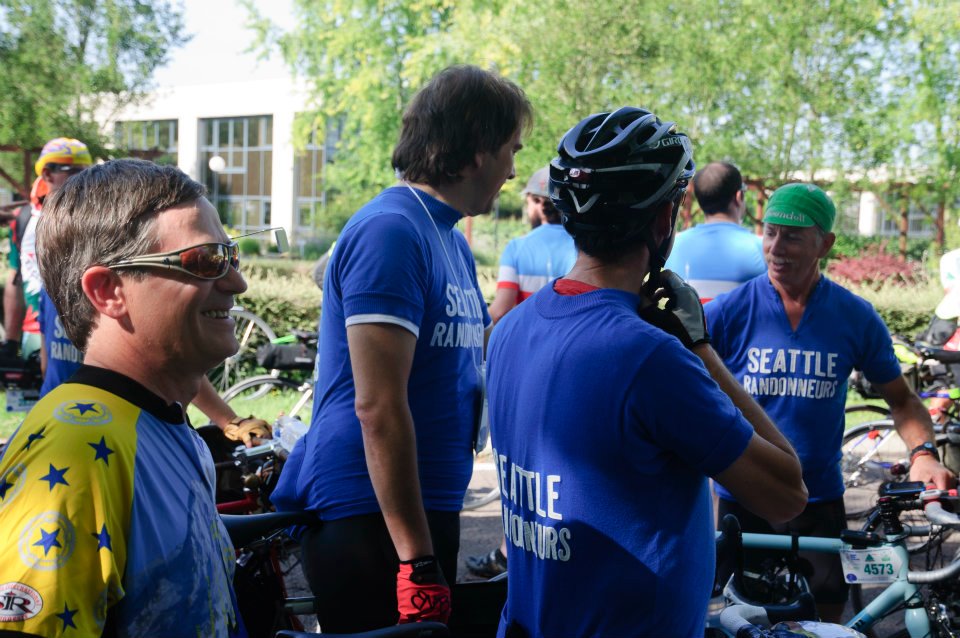
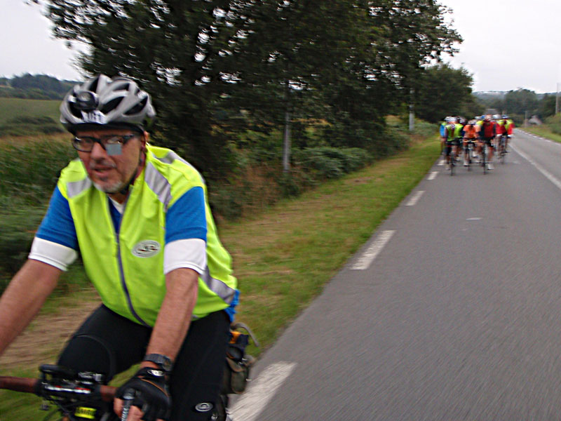
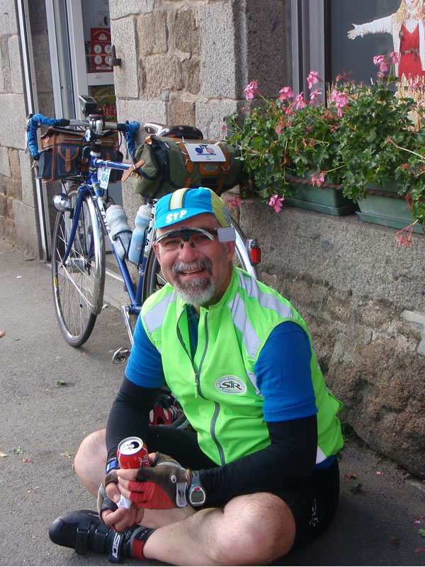
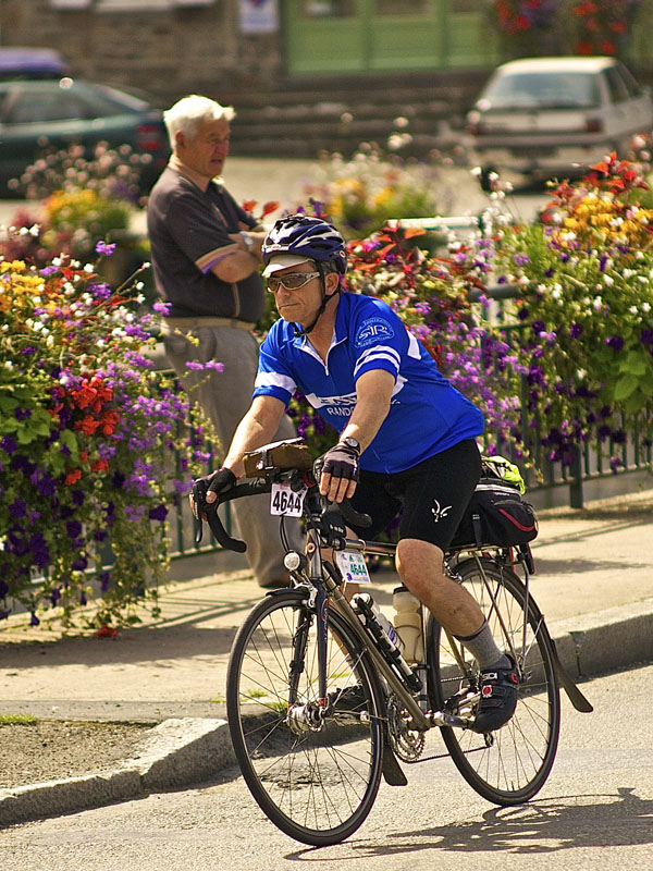
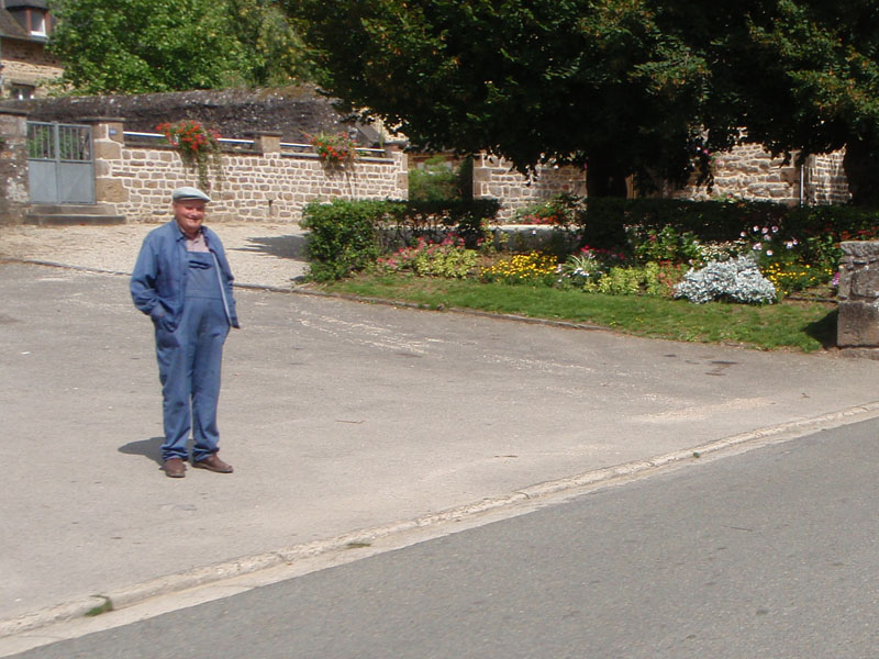
This is my Friend Will Goss waiting to enter the start area, looking pretty relaxed. He looked a little less relaxed in the picture I took 450 miles later.
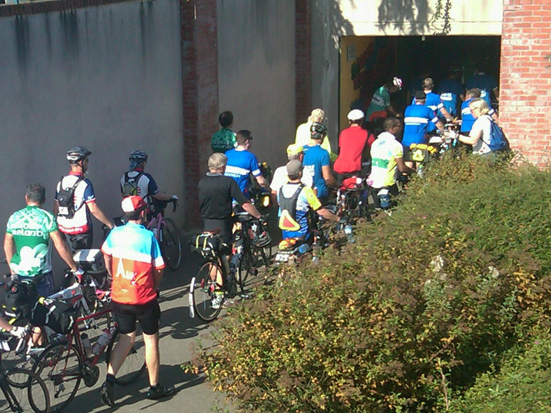
Entering the tunnel that leads into the start area. A big group of Seattle blue shirts went in together. "Abandon Hope All Ye Who Enter Here".
There were a couple of thousand people already in the stadium when we got close. There was a shady area on one side of the stadium but of course we didn't go there, we stood in the sun. That just how we roll.

We ended up at the back of the mass start because we were busy talking while everyone else was busy working their way forward. Fortunately some angels of mercy (family members) brought us water.
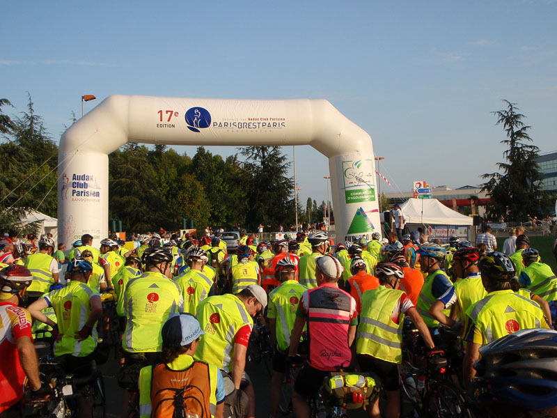
The massive crowd was squeezed down through a set of gates where our cards were stamped to prove we had been at the start. Then we filed out onto the road and waited some more until the group ahead or us left.
After they went we entered the final waiting area before launch, which I call "the pen". 20 more minutes of waiting while we fidgeted and listened to enthusiastic speeches in French (followed buy a much condensed English version thanks to Lois Springsteen of RUSA).
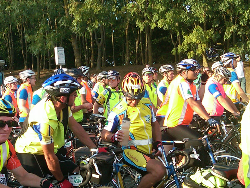
This is the start line from inside the pen.

While we're waiting, I'd like to discuss some events that took place before we reached the start line. This story begins in moderately deep time, about 430 million years ago in a time called the Silurian Era.
(Note on geologic names - most geologic terms were developed by Europeans in the 19th century. The names of the eras are associated with the area where they first discovered rocks of that age. The Silurian in particular is oldest fossil bearing rock found in Britain. The Silures were a Celtic tribe that lived in Pre-Roman times in Southwest Wales, where the rocks were found. These days, this terminology (like many technical languages) serves to obscure rather than reveal the information it contains so that only the initiated know what you are talking about. I am not a geologist (or a historian) so everything here is presented without guarantee.
For your convenience, here is a geologic time reference table:
|
||||||||||||||||||||||||||||||||||||||||||||||||||||||||||||||||||||
In Silurian and Devonian time there were 2 major continents, now known as Gondwana and Laurasia (or Laurussia or "The Old Red Continent". Srsly.).
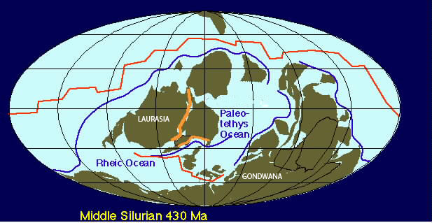
There was a land mass called the Armorican Terrane (about the length of Japan) located between them. Armorcia is what the Romans called Brittany, derived from the Gaulish word for "coastal area".
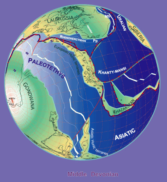
Over about 50 million years the two continents collided with each other to form the supercontinent known as Pangaea.
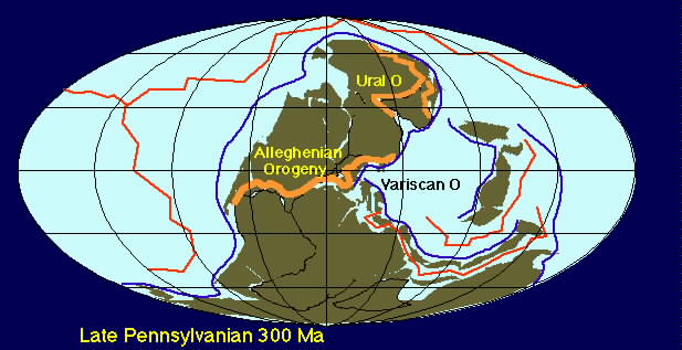
Pangaea was all of the continents assembled into one giant landmass. When Pangaea came together the Armorican Terrane was caught between the hammer and the anvil. This event squeezed, folded, and pushed up the rocks of Armorica and formed a mountain chain. The process heated and recrystalized the relatively soft rocks into a hard metamorphic core and intruded molten rocks from deeper in the earth. The line in the last figure marked Alleghanian and Variscan Orogeny (aka the Hercynian Orogeny for obscure reasons - orogeny just means mountain forming event in geologese) is the mountain chain formed by the collision. Armorica was near the middle of the line. The mountains of Brittany were then adjacent to the mountains of eastern North America and they were big. We can't know for sure how big the mountains were but given the location at the point of contact between the continents they may have been higher than the Himalayas.
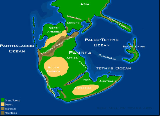
300 million years, it turns out, is a really long time. The Armorican mountains that once stood so tall were worn away to the bones of metamorphic and intrusive rocks. All that is left now is...

the Roc Trevezel (and the other Monts d'Arrée). So we were fortunate to be riding now and not 300 million years ago. Not only were the mountains much taller but the roads were way worse and there were hardly any cafes.
Pangaea broke up when the
Atlantic Ocean and the Mediterranean Sea formed. The Central
Pangean Mountains were spread far and wide, to North America,
Spain, Portugal, Ireland, Scotland, North Africa, Germany, and
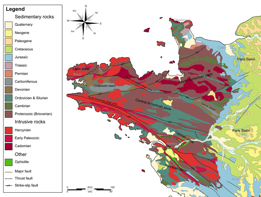
of course Brittany. The next figure shows the geology of
Brittany today. Our route was generally near the line marked
North Armorican Shear Zone. The eastern edge of the map shows
the edge of the Paris Basin which contains the rest of the PBP
route. The same rocks that are exposed in Brittany lie under
the surface sedimentary rocks in the Paris Basin. The sediments
came after Pangaea broke up and some were from erosion of the
Armorican mountains. Those sediments form the rolling hills of
Isle de France, Centre, Normandy, and Pays de la Loire that we
rode through to get to Bretagne.
Why do people believe that this is how things came to be what they are? Well, the rock chemistry and the magnetic alignment of the rock crystals, combined with the fossils embedded in the rocks lead to the conclusion that they were together once. The time span comes from watching how fast natural processes occur today and projecting that back to when the must have started assuming they are fairly constant.
In the interest of
equality, here is an alternate version. Depending on where you
were raised, you may have learned this version in school:
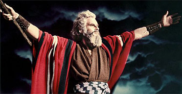
A bearded white guy who looks sort of like Charlton Heston as
Moses created the earth as-is in 4004 BC and either a)Noah
forgot to put the extinct creatures on the Ark or b) God salted
the world with fossils to trick rational people into eternal
damnation. Please skip ahead in your text book to the Bronze
age.
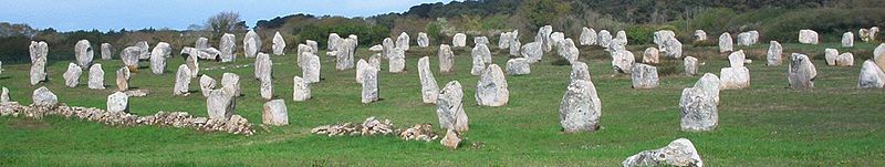
People have lived in the Paris Basin and Armorica for hundreds of thousands of years. Stone tools found in Brittany date from 700,000 years ago. Armorica (Brittany) has some of the best examples of "Standing Stone" fields in the world. That is where 5 or 6 thousand years ago people set megaliths (aka "big rocks"), some weighing many tons, up on on end in rows and columns. At Carnac in Brittany there are over 3000 large stones set in rows ordered by size, along with various structure made of huge stones. Some look at this and say "Why did they do it?" but I say "Why not?".
The stone age inhabitants or Western France were displaced by people who had figured out how to make tools from bronze. They had it pretty good until the folks with the iron tools showed up from Central Europe around between 1000 and 800 BC. The iron men became what we call the Celts. They were the dominant culture in Europe for about 800 years. Celtic tribes controlled an area from Ireland to Turkey and from the North Sea to the Mediterranean. That lasted until the Romans busted out of Italy around 50 BC. In fact, the Celts had sacked and burned Rome in 390 BC so you might say when the Romans showed up in France it was payback time.
At that time the most powerful Celtic tribe in Armorica was the Veneti. They were seafaring who traded with many other Gallic tribes on the Atlantic and English Channel coast. After initial submission to Roman rule, the Veneti revolted. They were initially successful but were in the end conquered by the Romans after a great sea battle that destroyed the Gallic fleet. The region became part of the Roman province Gaul Lugdunensis.
The legacy of Celtic settlement in France before the Romans is still felt today. Despite the concerted efforts of the French Government to suppress it over a hundred and fifty years, the Celtic Breton language is still used in Brittany. All of the road signs in Brittany are bilingual in French and Breton. Like many Celts, the Bretons are not a cooperative group of people when it comes to "outside" rules.
As I said before, I'm not a historian. This is not a scholarly article, there are no citations. We're just talkin' here. The history of France is complicated and messy. A lot of it is not pretty. People are still upset about things that happened in 1790 (and 56 BC for that matter). I could be wrong, in fact I'm absolutely sure I'm wrong about something in here. If you wonder about any of this I encourage you to research it and form your own opinions.
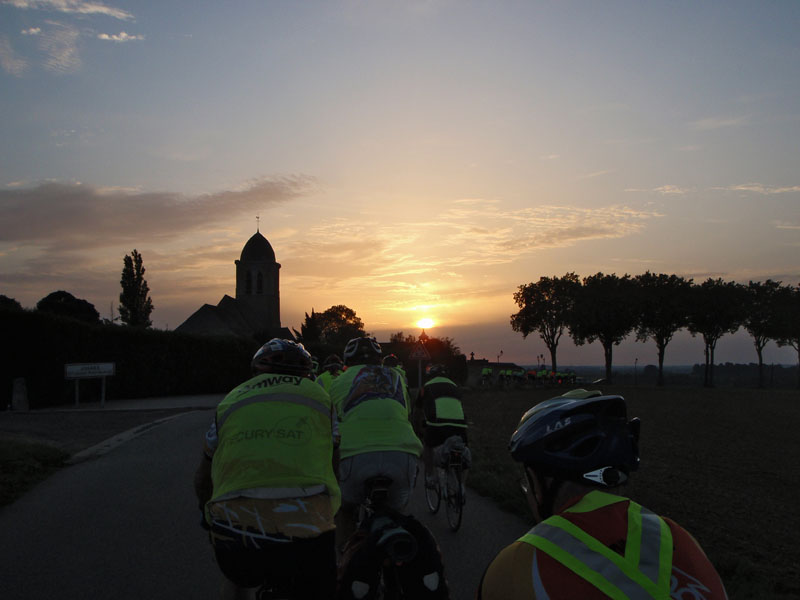
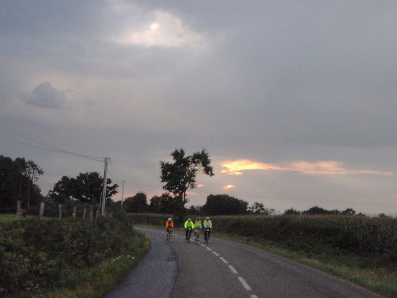
Finally, at 8:00 PM, they let us loose. At this point there were about 3500 riders on the course ahead of us.
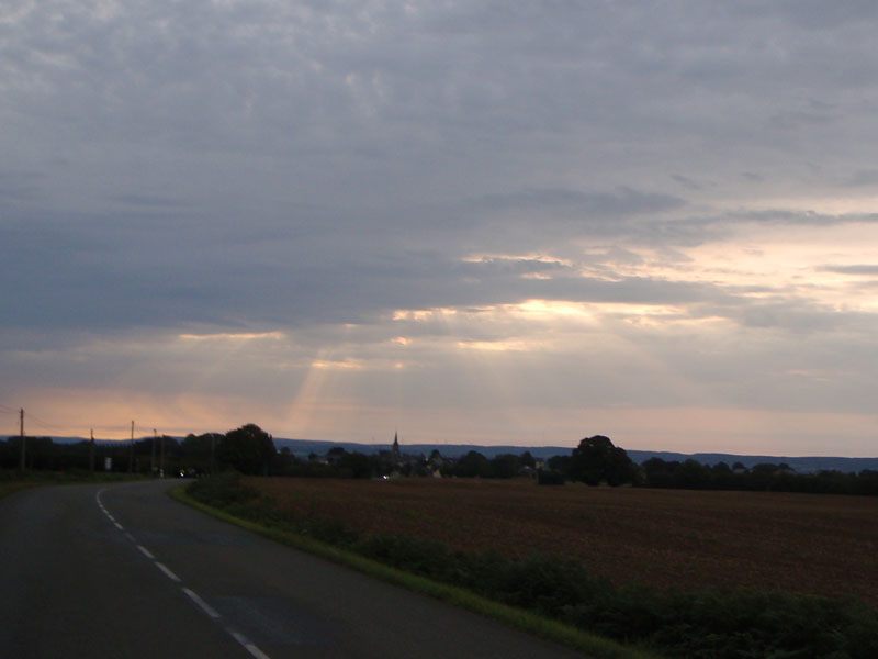
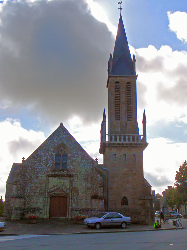
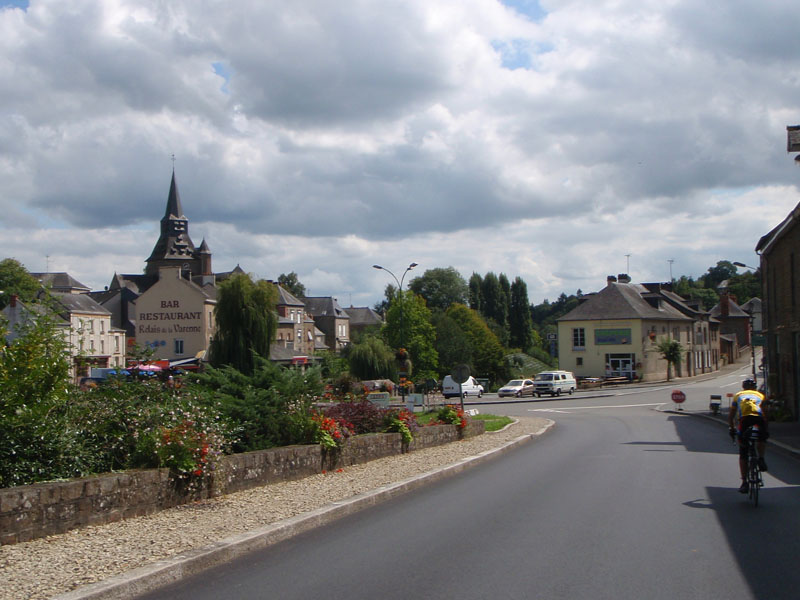
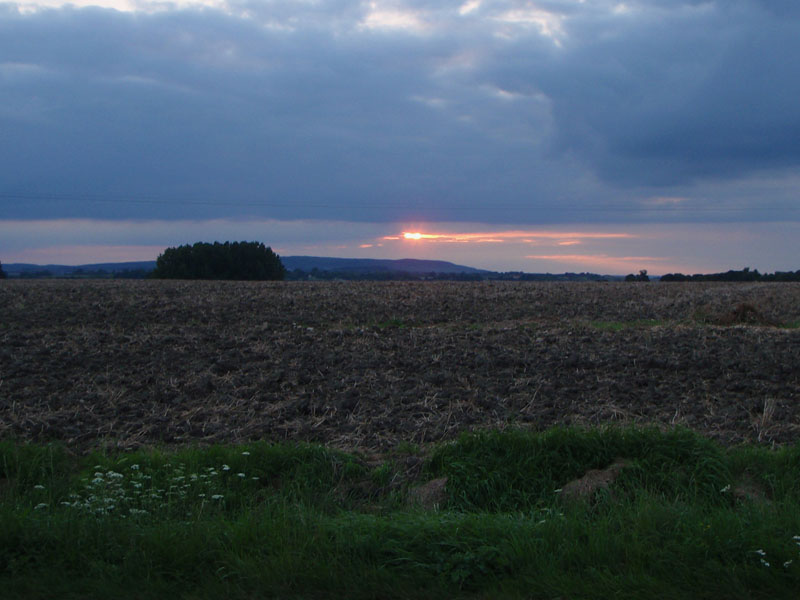
We were treated to a beautiful sunset over the village of Jouars-Pontchartrain. The name Jouars is derived from the name of the Roman City that was about 1 km west on the Mauldre River. There was a bridge there on the Roman road from Lutetia of the Gallic Parisii (aka Paris) to the main city of the Gallic Carnutes (now Chartres). Inhabitants of Chartres are called Chartrains, so the bridge would be the Pont-Chartrain. The church was built in the 10th Century but the dome was added in the 17th Century.
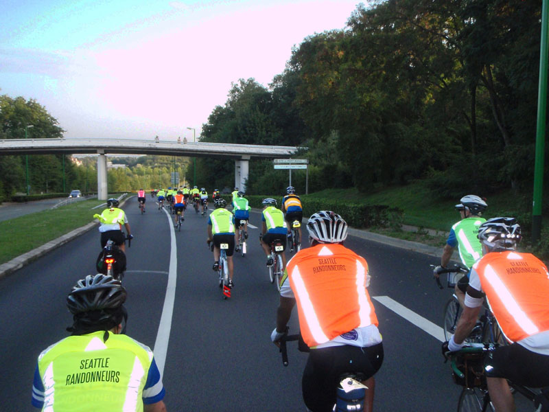
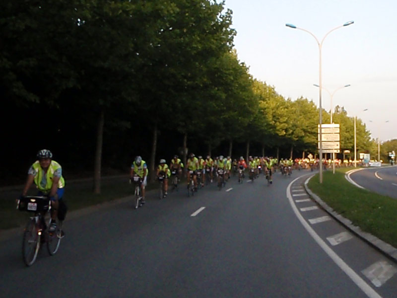
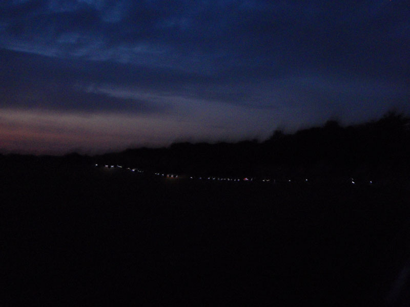
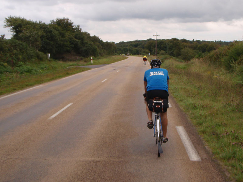
Here is part of the chain of 4000 riders stretching almost 200 kilometers from the start. The lead riders were about to reached the first control at Villaines while others were just leaving Paris when this picture was taken, I was about 40 km from the start.
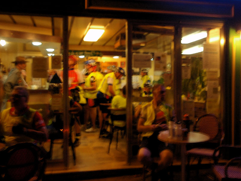
This is a typical cafe on the first night. Packed with riders as long as they decided to stay open.
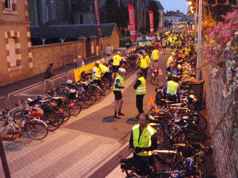
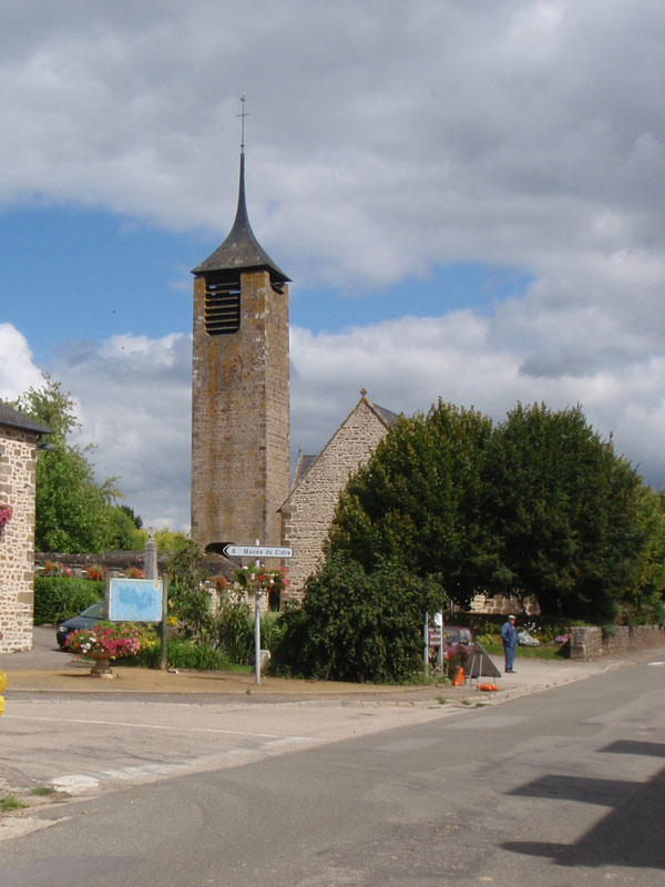
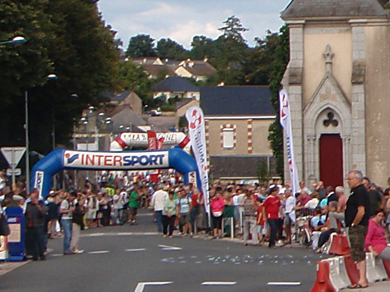
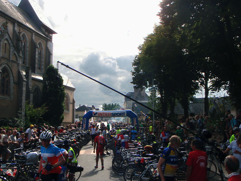
I rode through the night and arrived at the first official control at Villaines la Juhel around dawn. Villaines is one of the larger towns on the course. On the way back I found out that support for the ride from the townspeople is exceptional The bike storage area was a bit of a gauntlet though.
Shortly after leaving Villaines, I passed through the village of Charchigné. Notice the tent next to the church on the town square to shelter the riders if they needed it.

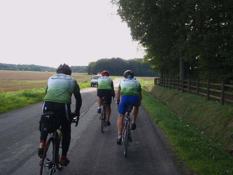
Clouds were gathering in the morning of the second day but there was little or no rain at that point. It was perfect riding weather for me - not hot, not cold, not raining, and not windy.
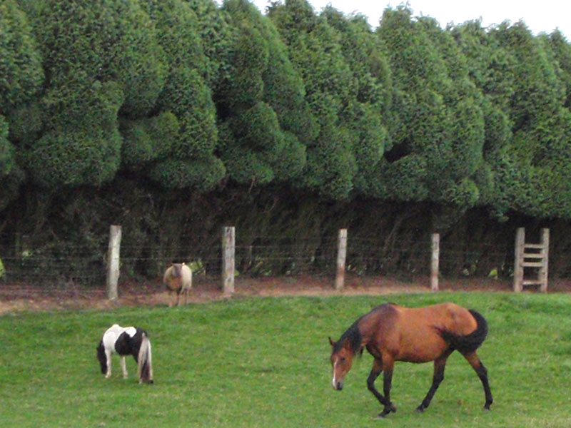
This stretch ran through the rich farmland of the Paris Basin. All of the animals looked very contented to me. I thought "This must be cow heaven". This is an example of the kind of things your mind does while you are riding your bike for 4 days.
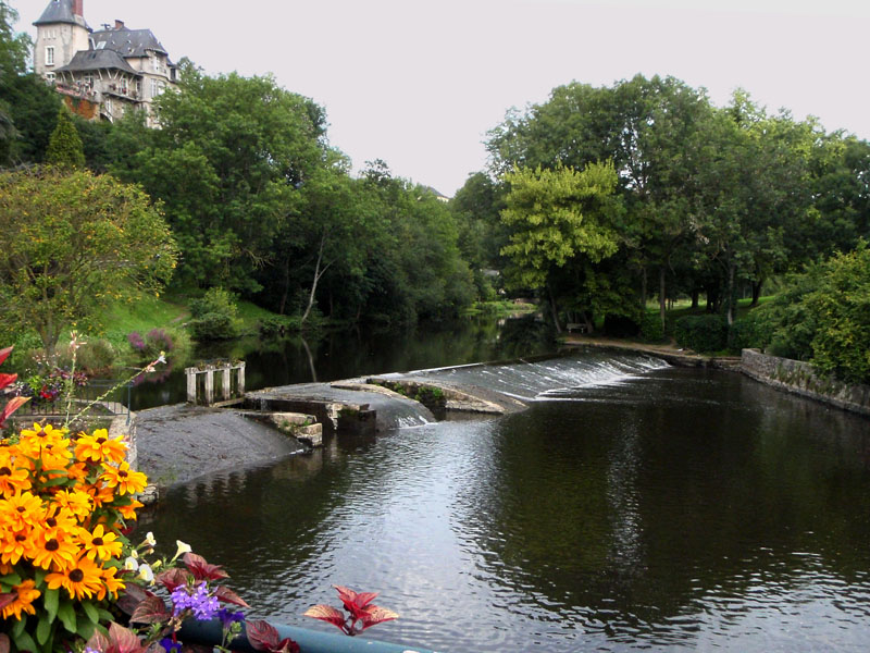
At about 09:00 I reached the beautiful bridge called Le Pont Landry over the Mayenne River near Ambrières les Vallées. I think this is one of the nicest spots on the ride.
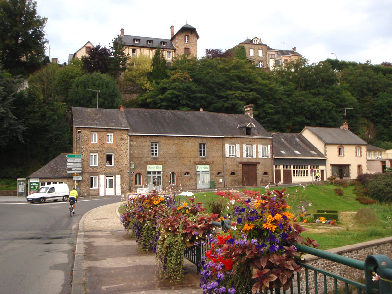
Ambrières les Vallées started in 1049 when William, Duke of Normandy (soon to be William the Conqueror, King of England) was fighting Henry I, King of France. William built a castle there on the border of Normandy to control the strategic confluence of 3 rivers,the Mayenne, the Varenne, and the Colmont. The bridge over the Mayenne came later but a bridge has been here for at least 800 years.
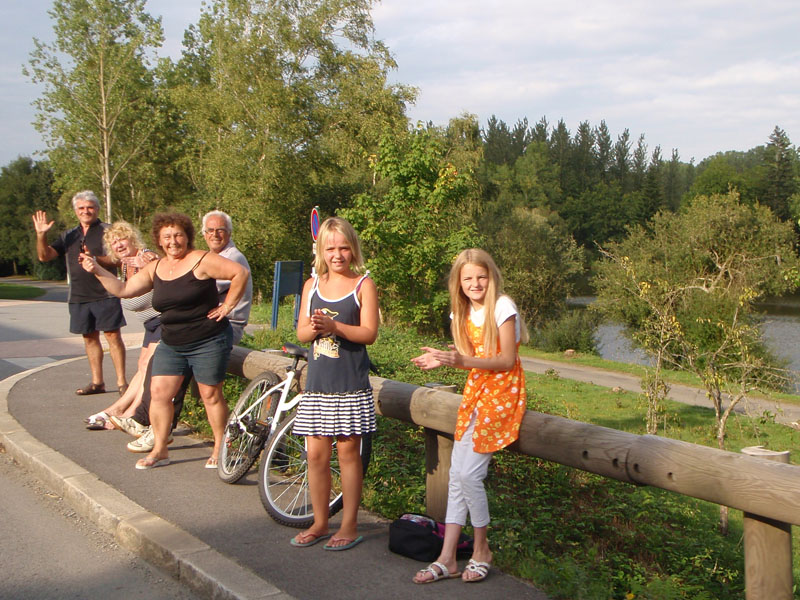
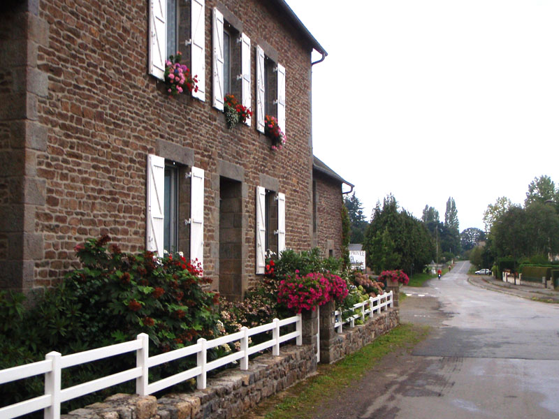
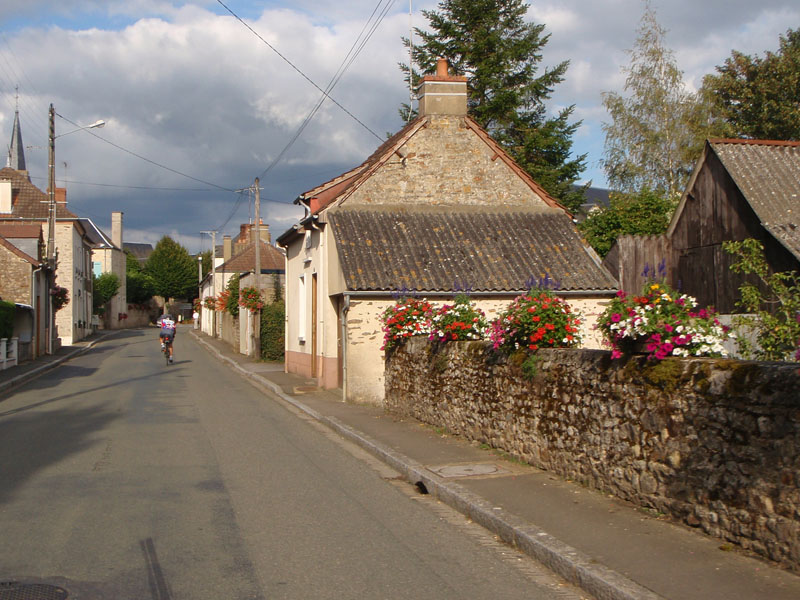
About 20 km from Ambrières les Vallées is the small village of Levaré. Like Ambrières les Vallées, the town rose up around an 11th Century Castle built near the border between Normandy and Brittany. Levaré is where I really started to understand what makes this ride so different from anything else I've done. It's the relationship between the people who live along the route and the riders. As I rode into town I passed several people, including a woman in a black dress who looked very old. She was leaning on a cane by the side of the road smiling and watching the riders go by. I could imagine her cheering the riders of PBP 1931. A few blocks later I passed a family standing by the town square who shouted "Bravo!" and "Bon Courage!" as I rode by.
At the other end of town there was a table by the roadside where a group of women and girls were giving away food, coffee, and water to whoever stopped there. They were not just for the fast riders but for all of us.
After Levaré I decided that I could not in good conscience abandon the ride unless there was an insurmountable problem. The French people had welcomed me, a total stranger, into their lives and had taken time to do what they could to help me along the way. My part of the deal was to have "good courage" and not give up until I reached the finish. It really struck me in my slightly addled state, 13 hours and 286 km into the ride. I know it's not a unique sentiment but I certainly found it to be a strong motivation over the next 3 days. I felt like I personally owed it to those people to finish.
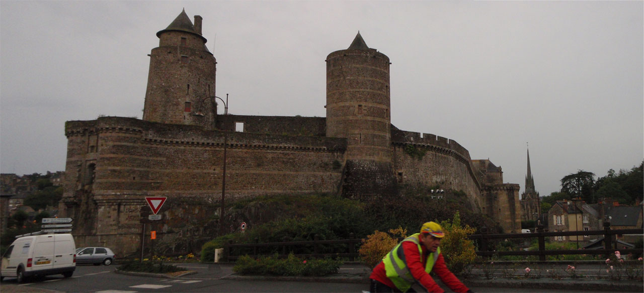
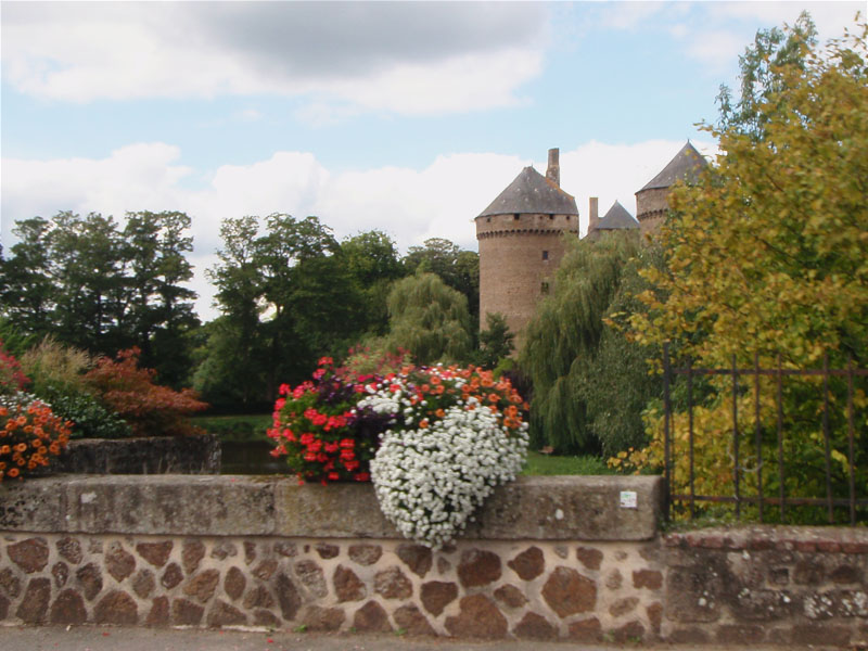
The next control was in the town of Fougères. It has one of the largest castles in France. The castle was first built in the tenth century near the border between Brittany and the kingdom of the Franks (the Franks were a Germanic people who came across the Rhine River and took over Gaul after the Romans lost control). Brittany had won independence from the Kingdom of the Franks in 851. Fougères was established in the military buffer zone between the two Kingdoms.
One question I had is: Why is it called Brittany? Legend has it that about the time of the Roman collapse there was a Roman General in charge of Britain called Magnus Maximus (presumably a big guy). He decided that he should be Emperor of Rome so he withdrew the garrison from Britain to march on Rome. When they crossed over the channel he gave command of Brittany to his trusted Gallic commander named Conan Meriadoc (I am not making this up). With the Roman soldiers gone, there was no one to defend the place when the Saxon invaders showed up around 400 AD. A lot of other Celtic people from Britain decided to head across the channel to get away so they became subjects of Conan. He lead the fight to maintain the independence of Armorica from the many tribes that crossed the Rhine to attack Roman Gaul in thos years. Mind you, this legend was used to justify the independence of the Dukes of Brittany from France and there is no record of it before the 12th century. There was a real link between Britain and Brittany though. There may not have been a Conan Meriadoc but there was a lot of migration from the British Isles at that time. The Breton language is not the Gaulish language spoken in Armorica in 56 BC. It is closer to the Celtic languages of Wales and Cornwall.
The weather that afternoon was mixed with some light rain...

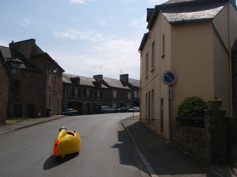
...and some sun breaks. At that time I was seeing a lot of the "Special" bikes: tandems, recumbents, trikes, things like that. This was one of the Velomobiles, a fully faired trike made in the Netherlands. It has one rear drive wheel and two front wheels. There were at least 4 of them on the ride. Very fast downhill but not so much on the climbs. I played leapfrog with them for much of the ride.
I rode with some friends for a while after the Fougères control: Lesli Larson and Susan Otcenas from Oregon and Jeff Loomis from Seattle. We passed through the town of Saint Méen Le Grande together. This is Lesli with Susan right behind her.
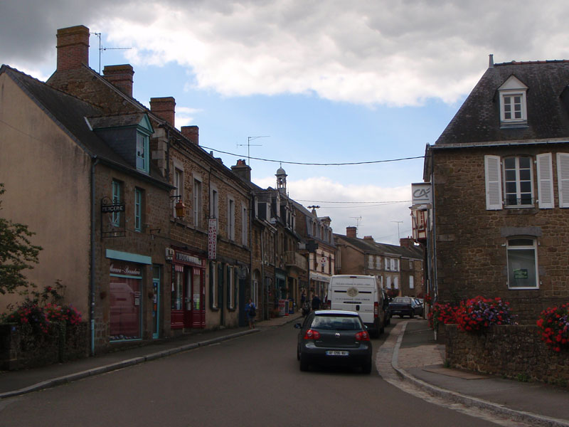
Saint Méen Le Grande is located on one of the Roman Roads which were built after the region was conquered in 56 BC. The town hall is impressive and looks quite old but was really built in the in the 1930s in a quasi recreation of the 15th Century town hall in Gouda in the Netherlands. The St. Méen monastery really was built in 1024 AD though.

During the French Revolution, St. Méen supported the Republic against the Monarchy. This is notable because Brittany was a stronghold of resistance to the Revolution. Under the Kingdom of France the Bretons had enjoyed a lot of autonomy since a treaty was signed in 1532. They paid some tribute to the French King but they had their own laws, (a legacy of their independence from the Frankish Kingdom). One of the things that sparked the Revolution was excessive taxes on the poor to support foreign wars and the extravagant lifestyle of the Royals and their favorites. Brittany was almost an independent country so they were exempt from some of the most painful taxes. Also, there were a lot of devout Catholics in Brittany who objected to the Republican actions to control the Church. Some saw the incorporation of Brittany into France as a foreign invasion. The resistance lasted from 1791 until Napoleon Bonaparte took control of France in 1800.
The citizens of St. Méen still have an annual celebration on the anniversary of the execution of King Louis XVI on January 21st, 1793 where they take an oath of hatred for Royalty and Anarchy:"I swear hatred to royalty and anarchy, attachment and loyalty to the Republic and the Constitution". Napoleon tried to outlaw that custom in 1802 but they have apparently outlasted him.
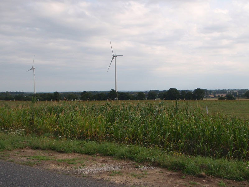
There were many wind generators in this area which is generally not good for cyclists because it means they have lots of wind. We had a fairly mild headwind on the way to Brest (another piece of luck). As you will see later, the windmills looked mighty odd at night.
I think this woman is hitchhiking. Sorry, I have as much on my bike as I can carry already.
When I entered Loudéac the crowds were large and vocal. It thought they were very enthusiastic. I didn't know at the time that the 16 fastest riders, including our own Chris Ragsdale, had passed through the Loudéac control on the way back to Paris 10 minutes before I got there on the way to Brest. At that point they were 350 km. ahead of me. But, hey, they had a 4 hour head start so I don't feel too bad.
Loudéac was my first long stop. One reason I had such a good ride is that I had a good first night there. Before the ride I was talking to wise man named Dan Driscoll (President of the Lone Star Randonneurs) about what advice he had for a first timer. He said "Don't try to go too far before you sleep. That can make the difference between having a good time and struggling to finish." It's hard to make up a big sleep deficit on the road. On that basis, I decided to stop at Loudéac unless there was a strong reason to keep going.
My drop bag was at Loudéac with clean clothes, food, tools, etc. I arrived at about 19:00 and ended up spending about 6 hours there. After I got my brevet card stamped, I went to look for some food. The cafeteria line was very long so I went across the bike entry path to where they had an outdoor grill. My meal was a very popular Breton fast food called a Galette Saucisse which is a pork sausage rolled in a buckwheat crepe. It's so popular that the soccer fans of Rennes have a song about it:
Galettes saucisse, je t'aime!
J'en mangerai des kilos (et des kilos !)
Dans tout l'Ille-et-Vilaine
Avec du lait ribot!Gallette Saucisse, I love you!
I eat pounds (and pounds!)
All through the Ille et Vilaine
With Buttermilk!
Possibly they were not drinking buttermilk when they wrote the song. I have to say, though, it was tasty. I then resupplied the bike for the next morning. I've found that no matter how tired I am before sleeping I will do a better job preparing for departure than I will in the first 1/2 hour after waking up. Then I grabbed a change of clothes and took a shower. The shower was nice but if you do this ride I strongly recommend that you BRING A TOWEL. What they provided was 2 paper towels. That didn't really cut it so I ended up using my clothes to dry myself. It was wonderful to get a shower and new clothes, though.
There were about 450 beds in Loudéac in two large gymnasiums but only about 100 were occupied when I went to pay for one. I'm not sure why that was. It was around 9 PM. Since 6PM, an hour before I arrived, almost 1200 riders had checked in at Loudéac. By the time I left at 1 AM all of the beds were full. I must have been just ahead of the rush. Maybe not waiting in line for food helped.
Another piece of advice for future riders: if you plan to sleep at controls, bring a set of ear plugs and a sleep mask. Hundreds of people will be coming and going while you are in the bed so the less you know about it the better.
While I slept, many riders including some of my friends pushed on to the next sleep stop at Saint Nicholas du Pelem 40 km away. That made perfect sense but they got nailed by a wild thunderstorm and were soaked by the rain. Then they ran out of beds there. I missed that completely because I was sleeping in Loudéac. That was pure luck, it could just as easily been the other way around if the storm had come through later.
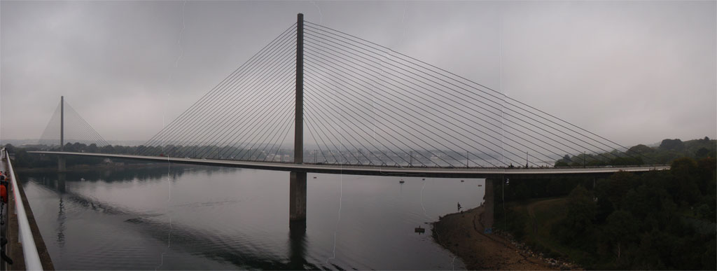
I left Loudéac at 1:00 AM. I had 7 hours of darkness ahead but I like riding at night. It sharpens the senses. At I moved west it became cold with fog and light rain. I got sleepy on the road for the first time after dawn on the climb up the Roc Trevezel in the Monts d'Arrée and on the descent to Sizun on the other side. The Roc Trevezel is the biggest single climb on PBP. It's 25 km. long but the top elevation is only about 1000 feet. Not a big climb by Washington State standards. Never the less, I had to stop and rest twice for 5 minutes along the road because I was starting to nod. At Sizun I stopped for a quarter hour at a bar to drink coffee and recover a bit. The visibility was very poor going over the hill and down into Brest so I took no pictures for about 160 km until I reached the beautiful Iroise suspension bridge over the Elorn estuary that feeds into Brest Harbor. The Elorn river starts as a small stream about 5 km. southwest of the top of the Roc Trevezel.
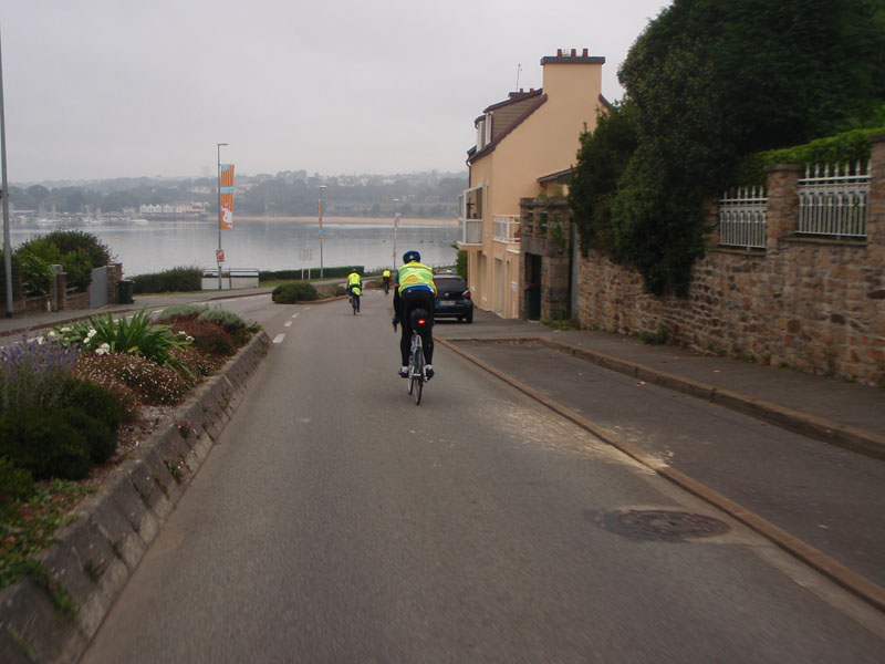
The ride route led across the older Albert-Louppe Bridge into Brest and down to the Harbor front. It was nice but at that time I just wanted to get to the control. It was 25 miles from Sizun to the Brest control and it seemed farther because I had it in my head that once I got to the bottom of the hill I would be able to stop. It was really about 2 hours later.
The port of Brest is an important Naval and commercial shipping center now but it was completely destroyed in 1944. After the Allied invasion of Normandy they were desperate to capture an intact port so they could move materiel quickly from the UK to France to support the Army. Also Brest was a major German submarine base. The Allies attacked Brest in July 1944. The city was held by elite German Paratroops who fought house to house to defend it under heavy bombing and artillery fire. Eventually the medieval city center of Brest was leveled by the battle. Only some old medieval stone-built fortifications were left standing, probably the ones we passed between the waterfront and the Brest control point. By the time the city was captured in September, the Germans had sabotaged the port so thoroughly that it never played any part in moving equipment to Europe for the war. It took 14 years to rebuild the city after the war.
 <
<I arrived at at the Brest Control at 10:45 and stayed for 2 hours. At that point I felt really good because I was half way there and had only used 39 out of 90 hours. I decided to try lunch in the cafeteria. While waiting in line, I started talking to an American rider who said he was going to abandon there at Brest because he had little or no sleep and thought would never make it back in time. I urged him to keep going, that there was lots of time and you never know how you will feel later. A Norwegian rider standing next to us joined in to say "Don't stop until you miss a control." I said "Don't stop until they take your card". Between us we convinced him to carry on. I'm happy to say he finished inside the time limit.
The cafeteria food was not spectacular but it was good and filling. I had chicken and rice, which made me think of my "Ballad of the Cascade 1200".
I saw a lot of my fellow Seattle Randonneurs at Brest. Everyone was happy to be at the turning point. I left just after my friends Don and Elaine Jameson who were doing the second consecutive PBP on their tandem. It took me over three hours to get back to the top of the Roc Trevezel. On the way I met up with another tandem couple from New Jersey, the Andersons, and we had a nice talk with them to pass the time. I had been kind of dreading the climb but it turned out to be not very hard.
When you come to the crest of the long climb out of Brest, the spot called Roc Trevezel is the hilltop your right and the radio tower on the left is on Roc Trédudon.

The radio tower on the Roc Trédudon was destroyed by a bomb attack in 1974. It knocked out televison in Western rittany for months. The destruction was claimed by Breton separatists but has proven fertile ground for conspiracy theorists since then. It was terrorists, no it was freedom fighters, no it was the military, no the security service did it discredit the separatists... Sound familiar?
Violent separatists were everywhere in the '70s - Brittany, Quebec, South Tyrol in the Italian Alps, the Basque region of Spain, Northern Ireland, Croatia, Indonesia, Israel, and many others. Plus ça change, plus c'est la même chose. At least these Bretons blew up an inanimate object.
The Breton separatists were one outcome of the French policy to ignore or suppress regional differences. The idea was that there is only one language and only one culture in France where every citizen is equal before the law. This is one product of the French Revolution. Except for brief intervals where one group dominated by force of arms, there never really was a unified France before the Revolution. It was more or less a loose association of states with differing culture, language, and laws. Regional rulers were frequently at war with each other. After the Revolution the differences were suppressed and loyalty to the Republic was made paramount. It was (and still is) illegal to track ethnic origin of French people in official records. Official recognition that there are in fact regional identities did not happen until the mid 1970s. The Breton seperatists attacked their real enemy. Television has probably done more to suppress minority languages than any government policy.
The "Celtic Nations" are Brittany, Cornwall, Ireland, the Isle of Man, Scotland, and Wales. They all have people who speak Celtic languages, though in the Isle of Man and Cornwall the languages were revived from near extinction. Later I passed a farmhouse that had large flags from each Celtic Nation hanging outside.

There were people who had driven to the top of the climb just to clap and cheer us at the top. To me it felt like winning the Alp d'Huez stage at Tour de France. I was so glad to be done with that climb I turned around and went back to take pictures. That's when I realized we had a significant tailwind. This next picture is the view looking back down toward Brest. The Roc Trevezel summit is on the left edge of the picture.

The 20 km descent was loads of fun. The sky was clearing, the road was good, and there were a lot of smiling randos headed east.
The tail end of the west bound riders were still heading up to the Roc. Most of them were 84 hour riders who had left on Tuesday morning so they still had time but some of them were on the 90 hour start so they would be right on the edge of the control closing time at Brest. I hope they made it.
One of my club mates, Dylan Carney, went by on the downhill. I rode with him for a little while but he was flying so I let go.
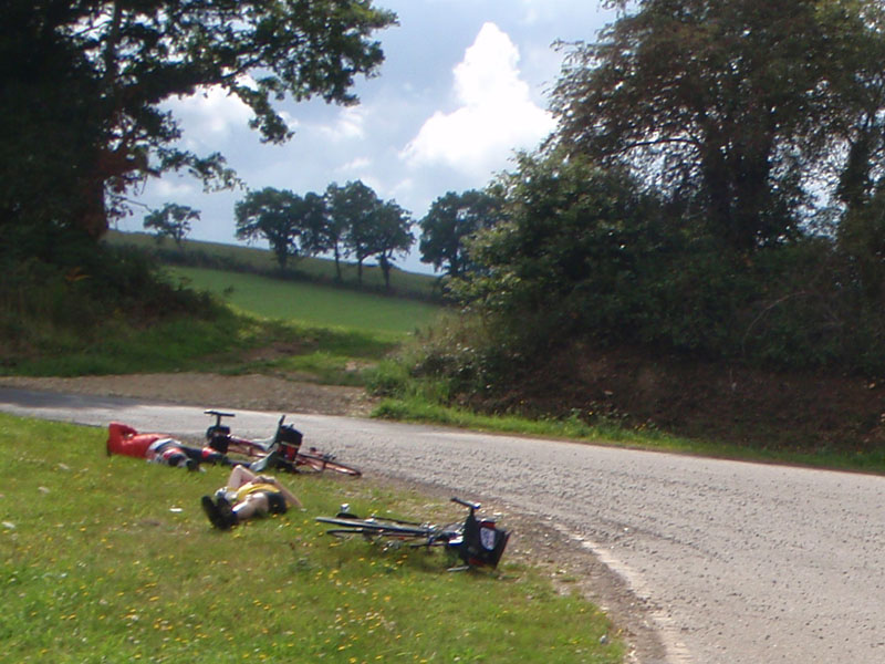
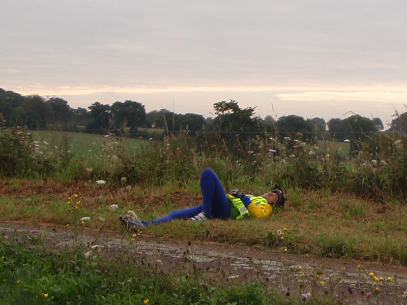
After Brest I started to see more and more riders sleeping along the side of the road. Unlike in 2007 (when I wasn't a rando yet) the weather was kind to us so a lot of people decided to take ditch naps.
Carhaix was one of the larges towns on the route. I got back there in the later afternoon and rode in with my friends from the "Soft Like Kitten" cyclocross team. Unleash your inner kitten.
There were a lot of people napping at Carhaix. I call this the Baked Potato pose.
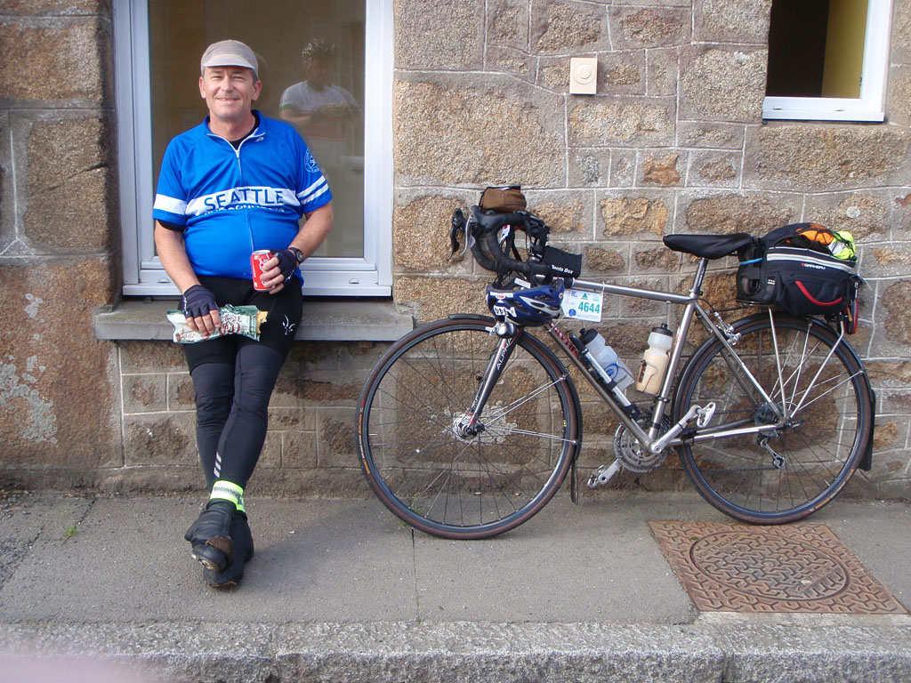
After Carhaix I rode for a while with my friend Will Goss. We rode a lot of the PBP qualifyiing rides together and we were on the same team for Fleche Northwest this year. He looks a bit worse for the wear at mile 464 compared to when he was waiting in line for the start but he finished strong.
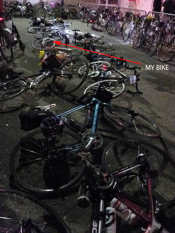
I arrived back at Loudéac at 22:30 and spent 4 hours. The bike parking was totally full. After searching for a while I just laid my bike down on the pavement in the special bike area. When I cam back to depart I found that others had followed my lead.
This time I changed clothes, restocked the bike and had a cafeteria meal. The meal wasn't planned but there was almost no line so I couldn't resist. Then I went to find a bed. This time there were probably 400 people sleeping there but I still didn't have to wait. I got an army cot with a very close neighbor who snored right in my ear. Fortunately the ear plugs and sleep mask allowed me to get a couple of hours of sleep before my wakeup call at 2 AM.
On the next leg I passed the same windmills I had seen on the way out but this time they were lit by flashing red lights. You could see the fan blades slowly turning when the lights were on which made it seem like they were moving. It was a war-of-the-world feeling. I, for one, was prepared to welcome our alien overlords.
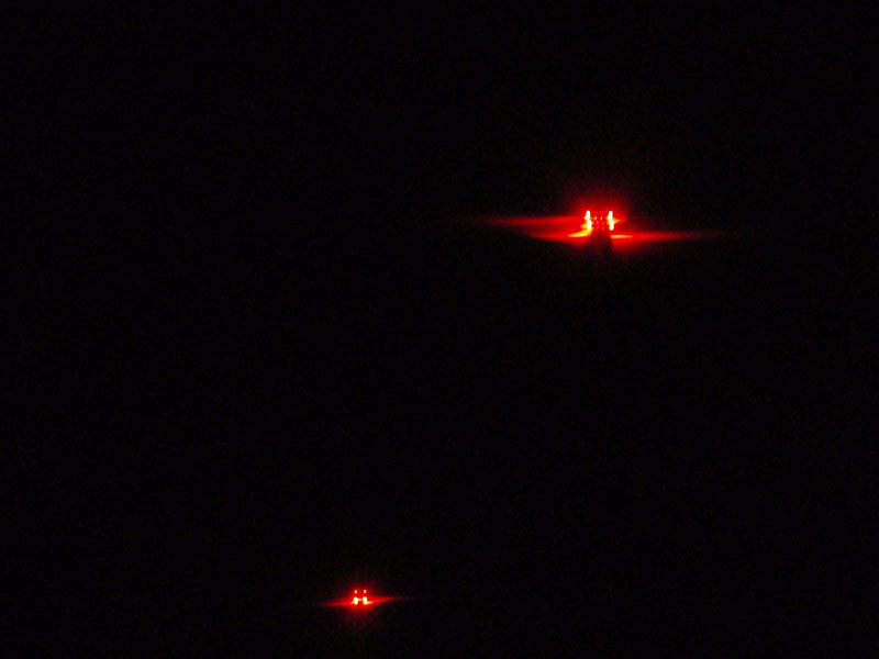
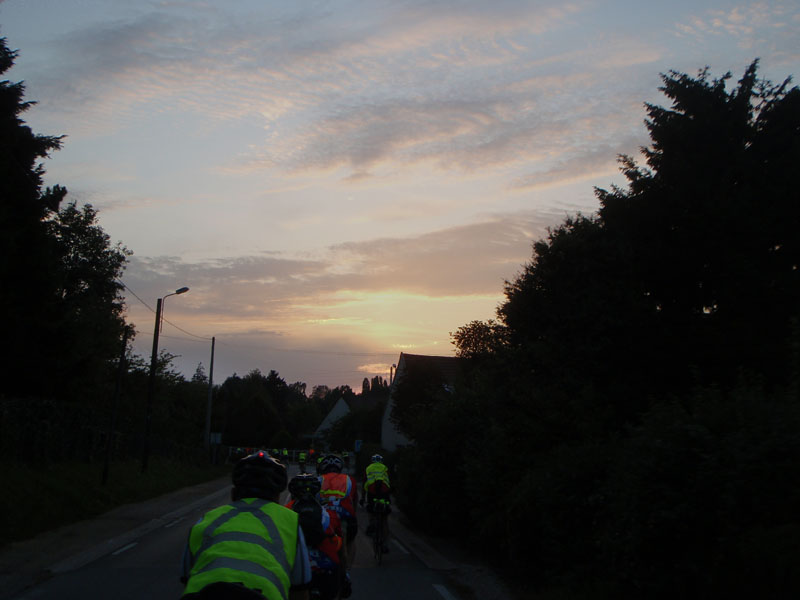
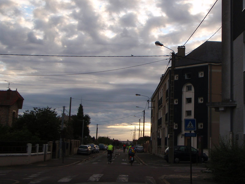
The is what the villages looked like at night. I was moving between groups, carried along by the river of riders.

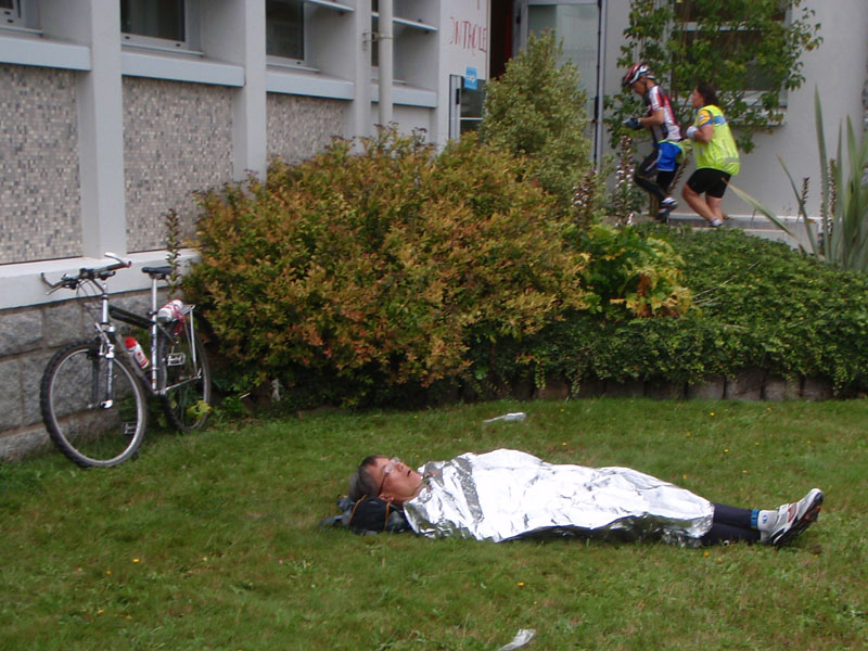
I was getting sleepy again once the sun came up so I stopped at Tinteniac control and slept for an hour on a bench at about 08:00. The bench was in next to the bike racks midway between the control and the bathrooms. The timing records say that over 350 people passed through the control point while I was there (with a sleep mask but no ear plugs) but I slept very well and woke up refreshed. I must have needed it.
When I got up a big group of Seattle Randonneurs had just arrived so I talked with them for a few minutes and rode on. I felt good. ; I soon passed through the charming town of Dingé. This is another town where they still celebrate the execution of Louis XVI and swear the oath.
Another sleeper. It looked quite peaceful there 10 feet from the highway. A lot quieter than the bench at Tinteniac I'll bet.
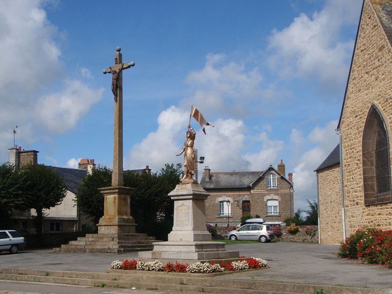
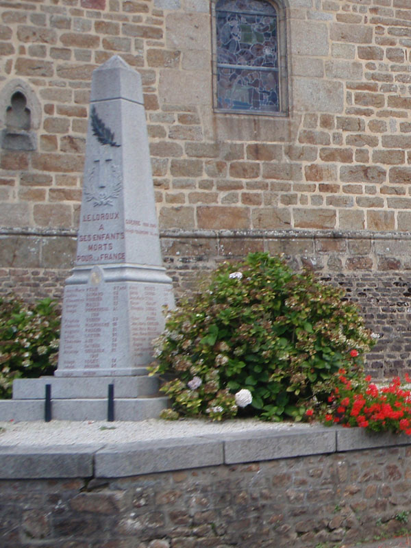
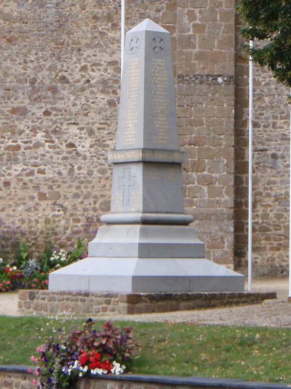
On the way back to Paris I spent more time stopping in villages and taking in the sights. I noticed that every village had a monument in a prominent place next to the church. I started looking at them and realized that every town had a monument for the soldiers who died in World War I with a long list of their citizens who were killed fighting in the war.
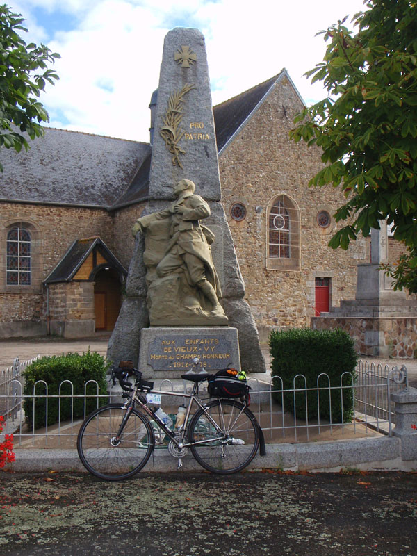
The battlefields of World War I never came to this part of France but the war did. Over 1.3 million French soldiers died defending their country between 1914 and 1918. For perspective on that number, it's twice as many soldiers killed as the United States has lost in every war we have fought since the American Revolution.

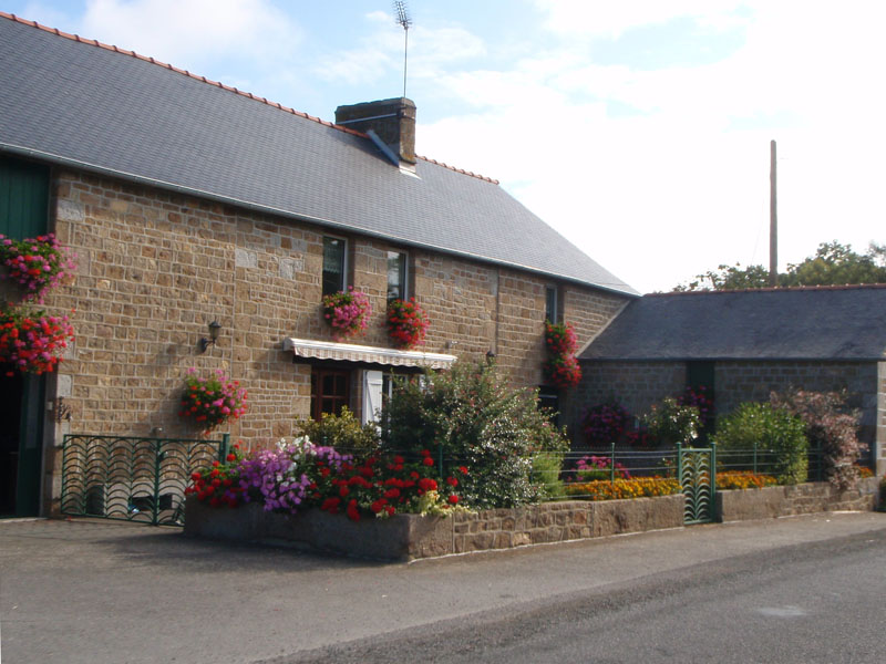
Still, life goes on. All we can do for the dead is try to learn from their lives. It was a beautiful day and the villages were decked out with flowers. It was good to be alive and out in the world.
I got back to Saint Hilaire des Landes at about 10 AM and decided to get a morning meal. My friend Joe Llona was there at the bakery. He was looking pretty happy right about then. I decided to join him.
I went in the bakery and got a fresh baguette sandwich and a Coke and sat back to enjoy the moment. This was at mile 565, 61 hours into the ride. Good times.
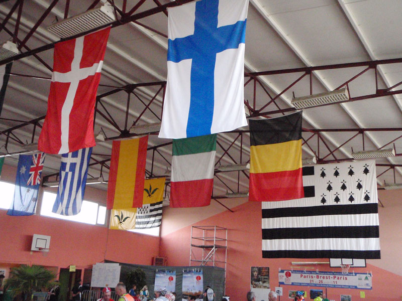
The next control was back at Fougères, less than 10 miles from Saint Hilaire des Landes. The control was in a a large building hung with flags from many of the participating countries. The largest flag is the flag of Brittany, which is based on the coat of arms of the Dukes of Brittany from 1316 to the French Revolution. The other flag in the third row back combines the flag of Brittany with the fern symbol of Fougères. Fougères means "ferns" in French.
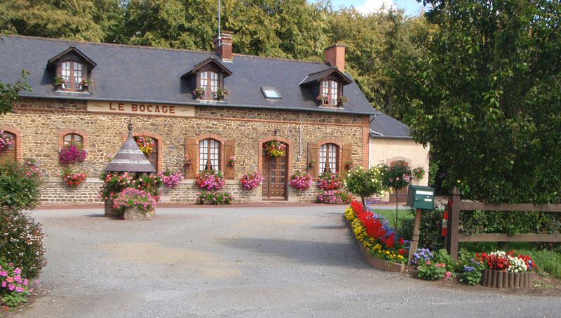
This is an inn just outside Fougères. "Bocage" is the name for the terrain of this area, mixed woodland and pasture with fields and roads sunken between narrow banks topped by thick hedgerows. This caused a lot of problems for the Allies during the Normandy invasion. Easy to defend, hard to attack. It provides no real protection but you can't see through it.
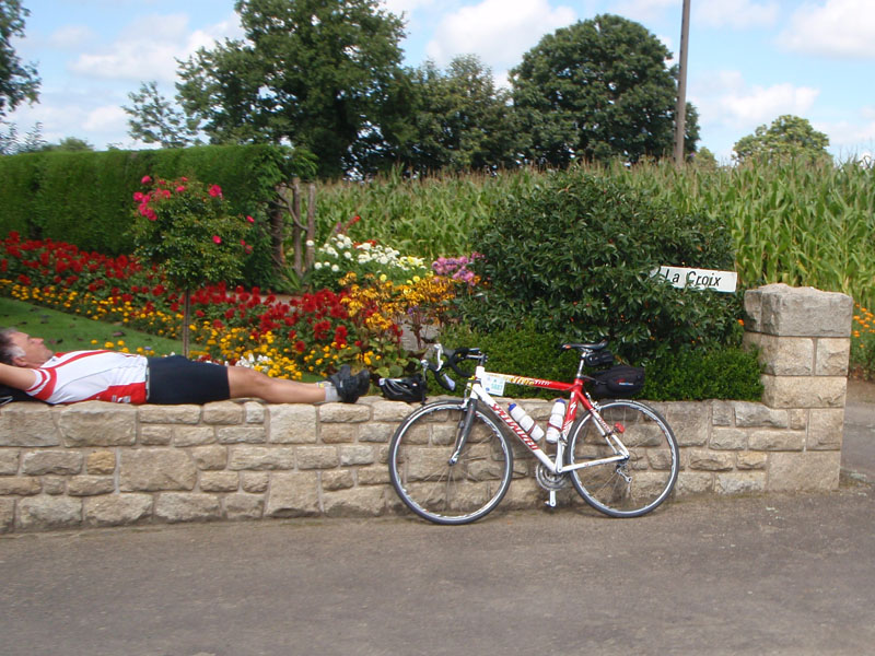
Sleeping on a stone wall doesn't seem to be bothering him. He and the bike match the garden nicely.
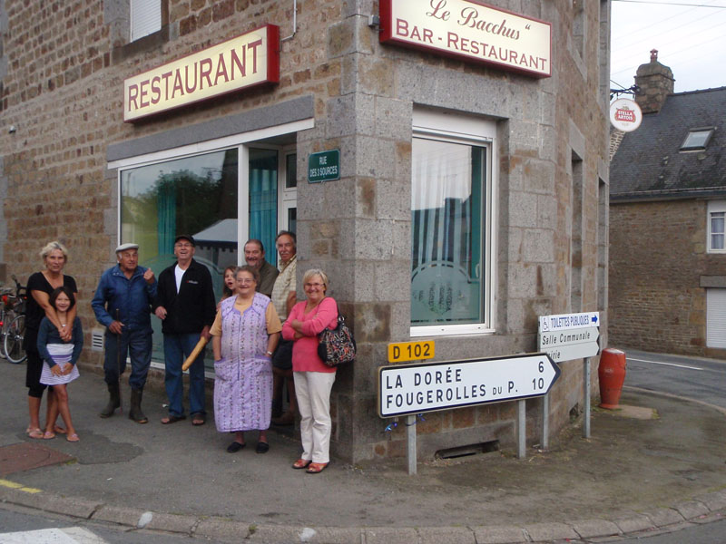
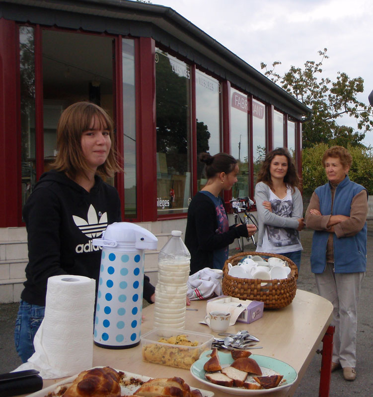
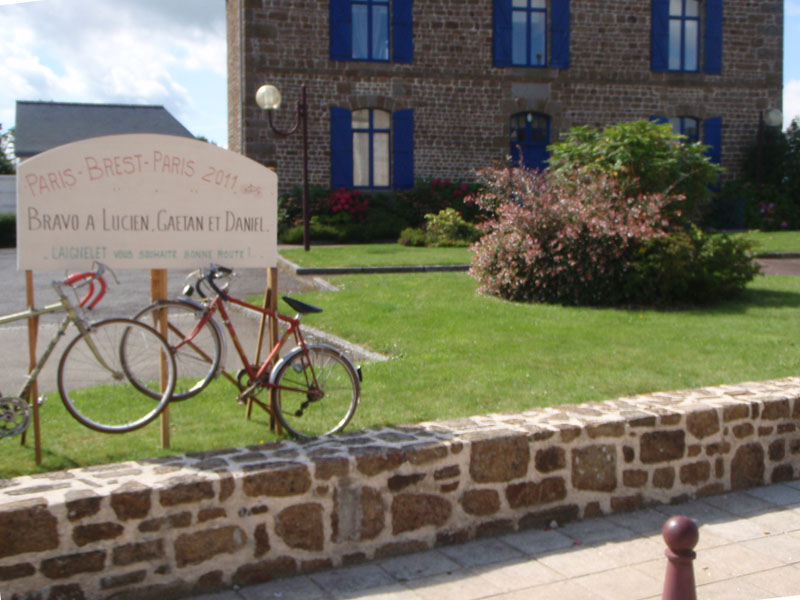
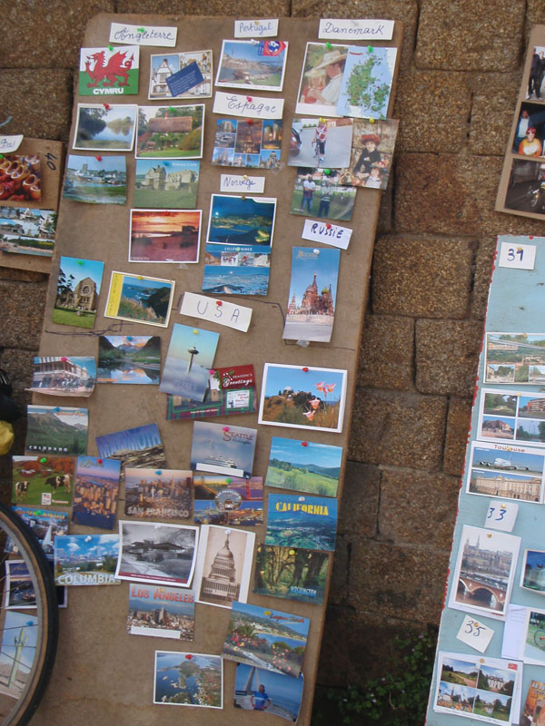
This next picture is one of the best known stops on the route. I heard about it from other randos long before I though of going to PBP myself. At this stop, M. and Mme. Paul Rogue give coffee, crepes, and hospitality to riders in the village of La Tanniere. All they ask in exchange is a post card from your home when you get back.
I got back to Ambrières-les-Vallées around 2:30 in the afternoon.
I happened to be crossing the Pont Landry when a professional photographer name Tim Wainwright, official photographer for Audax UK, was taking pictures. I think he got a good one. Good enough that I bought it from him. There are hundreds more of other riders available on this Picasa gallery.
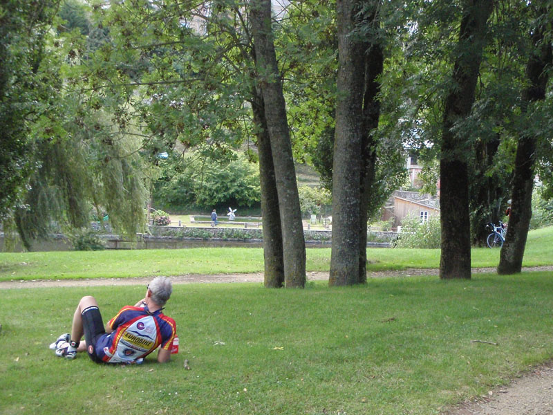
After crossing the bridge, I started up the hill on the other side. I was feeling kind of sleepy again so I stopped in a small park overlooking the river and laid down in the grass. I slept there for about 10 minutes and felt much better.
When I left, I saw this sign fifty feet up the road:

This was the "siesta". I think I was better off on the lawn. I was grateful for the water they gave me though.

I had 25 miles to go to the next control at Villaines ls Juhel. The time went quickly because of the beautiful scenery along the way.
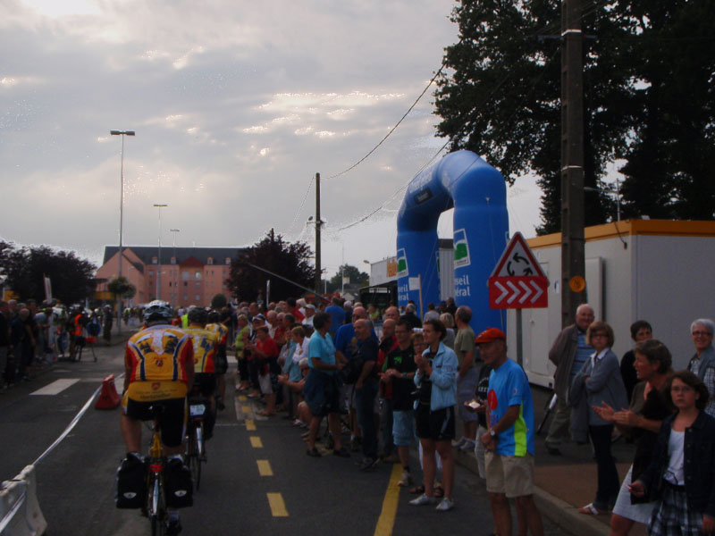
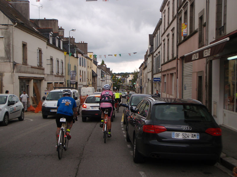
The stop at Villaines was beyond amazing. There were hundreds of people lining the streets on the way into the control. There was a Brazilian martial arts group performing to Samba music in front of the church. The reception at the bike area was crazy. There were television interviews going on. An announcer was calling out the nationalities of the riders coming in. The street was lined with cheering spectators. I felt like a rock star.

Villaines was just over 1000 kilometers which was a milestone for me. I had 140 miles to go and 20 hours to do it. I knew I would have time to sleep before the finish. After about 40 minutes at Villaines I pushed on. My goal was to stop at Mortagne au Perch for the night, about 50 miles away. I had about 4 hours of daylight left. I felt great after Villaines. The afternoon was beautiful and I was able to make good time on the rolling hills.
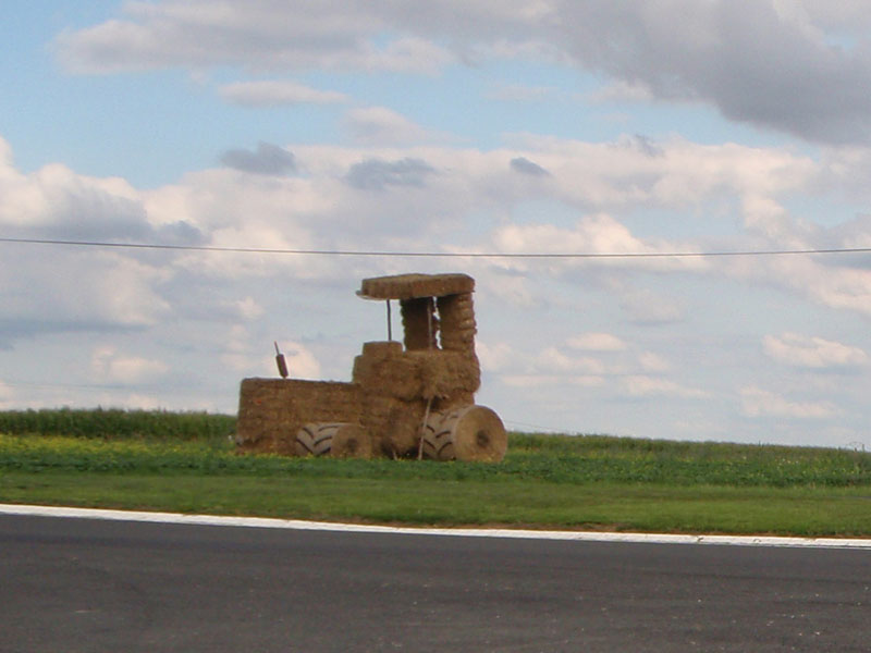
This is a tractor made of hay bails. I have seen things like this on TV along the roads during the Tour de France. The Tour went through this area a month before we arrived so I'm guessing it was built for them, not for us.
My third long stop was at Mortagne au Perche. I arrived at 21:30. At first I couldn't find control table because it was decorated to look like the original control stop from 1891 and lacked the sign that said "CONTROLE" in giant letters that I had seen at all the other stops. My ability to solve logical problems was somewhat limited by then, despite the presence of a table and volunteers in green shirts.
I finally met up with my friend Steve Davis at Mortagne. He had been ahead of me the entire ride but he had decided to slow down toward the end because there was plenty of time. We ate some food and decided to ride out together in the morning after some sleep. We found the sleeping area and I got in 2 or 3 hours of sleep. I spent about 5-1/2 hours in Mortagne and we left at 3:00 AM.
The last control before the finish was at Dreux. We got there at about 06:45 and checked in. I wanted to make it a quick stop in part because I thought it would be nice to come in under 87 hours (for no particular reason). Somehow I convinced myself thought Steve had already left so I took of alone. He was actually meeting up with a large group of Seattle riders when I left. They finished together.
The next stretch was mercifully flat for the first 25 km. This was the flattest part of the whole ride and there were few cars on that road.

The 8:00 AM sleepies got me again on that stretch. I had to stop and rest leaning against a concrete barrier at about 08:15. Not a real ditch nap but close enough.
The last bit to the finish was a repeat of the preride I had done a couple of days before the start. There were a few hills but it usually helps if you have done them before and know what to expect.
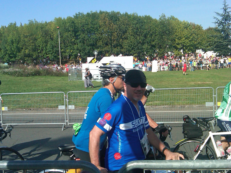
The finish was pretty chaotic. I came in at 10:47 on the 4th day, 86 hours and 47 minutes after we crossed the line. I still felt good. About 1000 riders finished within an hour of me and there were another thousand or two spectators, officials, and volunteers at the finish. I didn't take any pictures at the finish because I was too busy just being there. Also a friend who needed my help took precedence over everything else right then.
Even before I finished I was thinking about coming back in 4 years. I would like to get faster in the interim, not so I can finish sooner but so I can spend more time off the bike without pushing up against the time limit. I have always been happy with being a middle of the pack rider and this time I finished 27th out of 54 Seattle Randonneurs finishers. I would not have done anything different this time but next time I will spend more time riding with and talking to the amazing variety of riders out there. One thing I love about this sport is that it doesn't take exceptional athletic ability to be successful. It takes training, preparation, tenacity, and a bit of luck.
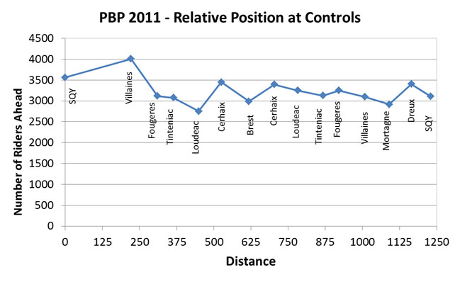
What made this ride more complicated than others I have done was having to make strategic decisions about where and when to sleep, eat, and rest off the bike. In all of the other multiday rides I have done the "overnight" stops were known at the start. It was just a question of when you got there that determined how much sleep you got. The biggest multiday ride I did before was the Cascade 1200 in 2010 with 100 riders. With 5000 riders it matters very much where you are relative to the crowd and you don't really know that at the time. One reason it worked so well for me at Loudéac on day 1 was that a lot of other people decide not to stay at Loudéac, some because they were not tired and some because they did not want to get up and ride 7 hours in the dark. About 800 riders came into Loudéac while I was eating and showering but only about 100 decided to go to sleep before I did. This plot shows where I was in the pack at each control from the timing chip data.
People often ask me what I think about on these long rides. One way I pass the time it by making up alternate lyrics that relate to the ride for songs I know. I did that on PBP. It's based on a Texas song by Gary P. Nunn called London Homesick Blues. If you don't know it, you can look it up on youtube to get the tune
I can't remember where I did it. I just know it was daytime and I was riding alone through the beautiful French countryside.
When your tires are flat and you ain't had a nap
In Carhaix you're a goner
You got 90 hours to make it to Paris
And don't take a minute longer
or you'll be cryin'
And there's no shortcut, can't take a train or a bus
You only have a bike to roll
So saddle it up and suck in your gut
And heard out for the next controle
(Chorus)
I want to be a rando-Ancien
From Paris to Brest right back to Paris again
The friendliest people and the prettiest country there's ever been
There's a family here ,they've come out to cheer
And wish you Bon Courage
Now it's up to you to make it through
So eat your jambon fromage
bagette sandwich
If you start to weave, you might need a sleep
So find ditch that's nice and dry
It might be hot, it might rain or might not
Keep goin' till you get to the line
(Chorus)
I want to be a rando-Ancien
From Paris to Brest right back to Paris again
The friendliest people and the prettiest country there's ever been
This report is written to honor the organizers and volunteers who make PBP possible and the people of France who made it such a wonderful experience. Merci beaucoup!